Auckland Council makes it easier to access flood data
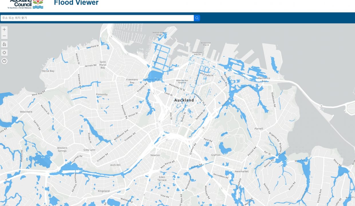
Flood Viewer is a map that displays information on floodplains, low-lying areas, water flow paths, and coastal areas that may be flooded during storms in the Auckland area. By entering the desired address on the website below, the map will show whether the area is a flood zone with a blue marker.
https://experience.arcgis.com/experience/cbde7f2134404f4d90adce5396a0a630/page/Flood-Hazard-Map/
Nick Vigar, the person in charge of the Healthy Waters plan, said that this information is intended to improve Auckland citizens’ awareness of flood risks and prepare for future disasters. He said that if Auckland residents know they live in a flood-prone area, they can plan to manage rainwater on their property and know what to do before, during, and after a flood. Residents can search for specific addresses or view an overview of the entire city. It also includes tips for improving their homes. This suggests more flexible ways to deal with it, such as moving vehicles and animals out of low-lying areas.
Nick said it is important for people to better understand the risk of flooding, and that building resilience in homes and communities while learning to live in situations where extreme weather and flooding occur more frequently. It will be useful information for people who are looking to buy or rent a home in Auckland. We have stated that understanding the flood risk of where we currently live and making decisions based on this information when buying or renting a new home will be helpful. Auckland Council is exploring ways to create space to hold water as an idea for improving the city’s stormwater system.

오클랜드 카운실: 홍수 지역에 대한 위치 정보 제공
Flood Viewer 는 오클랜드 지역내에 폭풍우 동안 홍수에 잠길 수 있는 범람원, 저지대, 물흐름 경로 및 해안 지역의 정보가 표시된 지도를 보여준다.
아래 웹사이트에서 원하는 주소를 입력하면 지도상에 파란색 표시로 그 지역이 홍수 지역에 해당되는 지에 관해 위치 정보를 알려 준다.
https://experience.arcgis.com/experience/cbde7f2134404f4d90adce5396a0a630/page/Flood-Hazard-Map/
Healthy Waters 계획 책임자인 닉 비거는 이 정보가 홍수 위험에 대한 오클랜드 시민들의 인식과 미래의 재난에 대한 대비를 향상시키기 위한 것이라고 말했다.
그는 오클랜드 주민들이 홍수 위험지역에 살고 있다는 사실을 안다면 자신의 소유지에서 빗물을 관리할 계획을 세우고 홍수 전, 홍수 도중, 홍수 후에 해야 할 일을 알 수 있다고 말했다.
주민들은 특정 주소를 검색하거나 전체 도시의 개요을 볼 수 있다. 또한 자신의 집을 더 개선할 수 있는 팁도 포함되어 있다고 밝혔다. 이로 인해 차량과 동물을 저지대 밖으로 옮기는 등 더 탄력적으로 대처할 수 있는 방법을 제안하고 있다.
닉은 사람들이 홍수 위험을 더 잘 이해하는 것이 중요하다고 말하며, 극한 날씨와 홍수가 더 자주 발생하는 상황에서 생활하는 법을 배우면서 가정과 지역 사회에 회복력을 구축해야 한다고 말했다.
이는 오클랜드에서 특히 집을 구입하려거나 임대하려는 사람들에게도 유용한 정보가 될 것으로 보인다.
현재 살고 있는 곳의 홍수 위험을 이해하고 새로운 주택을 구입하거나 임대할 때 이 정보를 토대로 하여 결정을 내리는 데 도움이 될 것이라고 밝혔다.
오클랜드 카운실은 도시의 폭우 시스템에 대한 개선안을 마련하기 위한 아이디어로 물을 가둘 수 있는 공간을 만들기 위한 대응책을 모색하고 있는 중이다.
